|
Remote Sensing Group. |
|
University of Lethbridge |


|
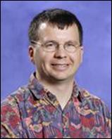
Dr. Derek Peddle |
|
Dr. Derek Peddle has conducted research into imaging science and technologies in areas such as Multi-angular and hyperspectral imaging, canopy reflectance modeling and image inversion, image classification and spectral mixture analysis algorithms/software development, field and laboratory measurement and image validation, and topographic and radiometric correction of airborne and satellite imagery. He has further conducted research into areas of the environment such as forests; including classification of forests, inventory of forests, structure and damage to the forest, the location and existence and results of forest fires, the amount of biomass, leaf area, tree height, and carbon absorption. He has also conducted research into the water including: watershed quantity, and riparian ecosystem health. Around the mountains he has conducted research into terrain analysis, wildlife habitat, permafrost and hydrology.
Biography
Dr. Derek R. Peddle |


