 |
Derek R. Peddle, Ph.D.
Professor of Geography Member of Executive (National Past-Chair):
|
|
Professional Biography
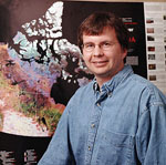
Dr. Derek R. Peddle is a Professor of Geography at The University of Lethbridge in Lethbridge, Alberta Canada. Born and educated in Canada, he received the Ph.D. Degree in Geography/Remote Sensing from The University of Waterloo (1997 National Best Ph.D. Thesis Award in Remote Sensing), M.Sc. in Geography from the University of Calgary (1991), and the B.Sc. Honours Degree in Computer Science and Geography (1987) and B.Sc. in Computer Science (1986: First-Class Distinction) from Memorial University of Newfoundland. During this time he also worked at C-CORE, NORDCO Ltd., the Institute for Space and Terrestrial Science, Wilfrid Laurier University, and NASA. In 1994 he received a NASA Visiting Scientist Award at the NASA Goddard Space Flight Centre (GSFC) with the Universities Space Research Association as one of 10 recipients internationally and the only Canadian. On Canada Day 1996 he was appointed to a tenure-stream faculty post as Assistant Professor at the University of Lethbridge. He was promoted to Associate Professor in 1999 and Full Professor in 2006. In 1999-2000 he was awarded an International Fullbright Senior Fellowship - one of 8 in Canada to receive this award that spans disciplines across the Arts and Sciences. The Fulbright Award in Environment and Climate Change was held while on sabbatical study leave at NASA GSFC and the University of Maryland, where he worked in the Goddard Terrestrial Physics Laboratory, Biospheric Sciences Branch, and where he is presently a member of the NASA MODIS Science Team. In 2006, he was awarded the Canada-U.S. Fulbright Distinguished Visiting Research Chair at the University of California Santa Barbara. Other awards have included the National Award for Excellence of Scholarship from the National Council for Geographic Education, the Canadian Cartographic Association National Medal, the National Forest Climatology Award, the James Cook Memorial Award, as well as two Awards of Distinction from the Alberta Heritage Foundation, five Alberta Research Excellence Awards, NSERC and Killam PDFs (both declined), and the Alberta Centennial Medal (2005). His NSERC-funded research program involves remote sensing, GIS, and earth system science modeling in studies of global environmental change and terrestrial ecosystem dynamics, with applications in forestry, agriculture, water, mountain terrain analysis, and integrated resource management, and supported by algorithm development. He has participated in numerous
international research programs and field campaigns as scientist and/or
principal investigator, and published over 140 papers including over 60 in
refereed scientific journals and 6 that received best paper awards at
national/international symposia. He is presently an Associate Editor on the
Editorial Board of the Canadian Journal of Remote
Sensing and has served on a variety of
national and international science advisory committees and review panels
such as NASA, NSF (USA), NERC (UK), CSIRO Australia, and various agencies in
Canada as well as international journal reviewer (IJRS, RSE, IEEE, PE&RS,
JGR, CJRS etc.). He is currently National Past-Chair/Président of
the Canadian Remote Sensing Society (CRSS) on the CRSS Executive, having served previous terms as National Chair, Vice-Chair, Secretary-Treasurer and Prairies Regional Chair. He
is a member of CRSS,
the IEEE Geoscience and Remote Sensing Society, the Canadian Association of
Geographers, and the Alberta Geomatics Group (Founding Member, AGG
Lethbridge Chapter). From 2003-05 he served as the faculty representative on
the University of Lethbridge Board of Governors and Senate. He was General Conference Chair and Technical Committee Co-Chair of the 30th Canadian Symposium on Remote Sensing, June 22-25, 2009, hosted at the University of Lethbridge. Undergraduate Teaching
Programs: Students may also pursue Co-op and work-term options, and/or the Honours Bachelors degree. Computer
Science/GIS Major NSERC CREATE AMETHYST Grant In 2010, the University of Lethbridge was awarded a 6 year NSERC CREATE Grant. The NSERC Collaborative Research and Training Experience (CREATE) Program on Advanced Methods, Education and Training in Hyperspectral Science and Technology (AMETHYST) provides a variety of opportunities for undergraduate, M.Sc., Ph.D. and PDF trainees, including internships with our international partners. Please see our AMETHYST program web site for details: http://www.uleth.ca/fas/amethyst/ Please contact
me for further information if interested in this research
program. Additional information on
research themes is listed
elsewhere on this site. Concentration in the
Geographical Information Sciences (CGIS):
Derek Peddle’s primary research
interests are in the fields
of remote sensing, GIS, and Earth System Science modeling
in studies of global environmental change.
Using an integrated
research approach, key environmental indicators are being investigated in different parts
of the world at dynamic spatial and temporal scales. Research Funding This research program
has received support from the following
agencies / programs:
Research Projects
1. Forest Ecosystem Dynamics Research focus: - Remote estimation of forest biophysical parameters (biomass, LAI, NPP) in studies of biospheric-atmospheric exchange within the global carbon cycle. - Spectral mixture analysis and canopy reflectance modeling of airborne and satellite imagery - Field studies:
analysis of
understorey reflectance in boreal forests Major Projects: BOREAS: Boreal Forest Ecosystem Atmosphere
Study - western Canada. NASA COVER
Project: Superior
National Forest, Minnesota USA. Collaborating scientist with
NASA Goddard Space Flight Center. 2. Mountain Terrain Analysis Research focus: - Alpine and montane land classification and biophysical analysis using remote sensing - Digital terrain modelling and image texture analysis - Modeling permafrost distribution and active layer depth - Deriving new
hydrological and
climatological variables using GIS Canadian Rocky Mountains (Alberta, B.C.) Colorado Rocky Mountains, USA. Southwest Yukon Territory Appalachian
Mountains, Eastern
Canada. 3. Remote Sensing in Agriculture and Water Resources Research focus: - Spectral mixture analysis of agricultural crops - Multiscale field and airborne remote sensing of biophysical properties - Use of GIS, GPS in Precision Agriculture and Water/Irrigation Studies - Watershed Studies - Topoclimatic Indices in 5 Rocky Mountain Study Sites - Riparian Remote Sensing - P.I. on 2 Alberta Ingenuity Centre for Water Research (AICWR) projects. Study Areas: Agriculture: southern Alberta, Saskatchewan; Water: Rocky Mountains, prairies
4. Algorithm Development To facilitate advanced research applications, I design and implement new algorithms in software which are not available in commercial remote sensing image analysis and GIS packages. This has involved software development for: - Image texture analysis - Geomorphometric processing of digital elevation models - Analysis and classification of multisource data (e.g. GIS, optical/radar imagery, DTM) - Data processing and analysis: radar noise detection, sampling, reflectance processing, accuracy assessment, interface to atmospheric models - Spectral Mixture Analysis and Canopy Reflectance Modeling of Biophysical Structural Information - Time Series Analysis, and Temporal Mixture Analysis (TMA)
Summary of Publications: [Last Updated
2007]
REFEREED PUBLICATIONS SELECTED REFEREED PUBLICATIONS (as of 2007)
Peddle, D.R., R.B. Boulton, N. Pilger, M. Bergeron and A. Hollinger, 2007. Hyperspectral Detection of Chemical Vegetation Stress: Evaluation for the Canadian HERO Satellite Mission. Canadian Journal of Remote Sensing - Special Issue: HERO (in press). Soenen, S.A., D.R. Peddle, C.A. Coburn, R.J. Hall, and F.G. Hall, 2007. Improved topographic correction of forest image data using a 3-D canopy reflectance model in multiple forward mode. International Journal of Remote Sensing. (in press). Soenen, S.A. D.R. Peddle, C.A. Coburn, R.J. Hall, and F.G. Hall, 2007. Canopy Reflectance Model Inversion in Multiple Forward Mode: Forest Structural Information Retrieval from Solution Set Distributions. Photogrammetric Engineering and Remote Sensing. (in press). Peddle, D.R., R.L. Johnson, J. Cihlar, S.G. Leblanc J.M. Chen and F.G. Hall, 2007. Physically-Based Inversion Modeling for Unsupervised Cluster Labeling, Independent Forest Classification and LAI Estimation using MFM-5-Scale. Canadian Journal of Remote Sensing 33(3): 214-225. Xu, S., D.R. Peddle, C.A. Coburn and S.W. Kienzle, 2007. Remote Sensing of Net Primary Productivity and Carbon Dynamics in a Rocky Mountain Watershed, Kananaskis Alberta: Sensitivity of the BEPS Model to Climatic, Water, Terrain and Forest Biophysical Parameters. Canadian Journal of Remote Sensing (submitted) (now: accepted). Eddy, P.R., A.M. Smith, B.D. Hill, D.R. Peddle, C.A. Coburn and R.E. Blackshaw, 2007. Hybrid Segmentation - Classification of Very High Resolution Ground-Based Hyperspectral Imagery for Site-Specific Herbicide Management in Agriculture. Photogrammetric Engineering & Remote Sensing: Special Issue on Artificial Intelligence in Remote Sensing. (submitted) (now: in press). Van Gaalen, K.E., L.B. Flanagan and D.R. Peddle, 2007. Photosynthesis, chlorophyll fluorescence and spectral reflectance in Sphagnum moss at varying water contents. Oecologia. 153:19–28 Coburn, C.A. and D.R. Peddle, 2006. A Low-Cost Field and Laboratory Goniometer System for Hyperspectral Bi-directional Reflectance Estimation. Canadian Journal of Remote Sensing 32 (3):244-253. Peddle, D.R. and A.M. Smith, 2005. Spectral Mixture Analysis of Agricultural Crops: Endmember Validation and Biophysical Estimation in Potato Plots. International Journal of Remote Sensing. 26 (22): 4959–4979 Peddle, D.R., N.J. Rabe, S.A. Soenen, and D.L. Johnson, 2005. Derivation of Topoclimatic Indices for Alpine Snowpack Analysis in Alberta Rocky Mountain Watersheds. In, International Proceedings (peer-reviewed): Canada-US Eastern Snow Conference, Waterloo ON., Canada June 7-11, 2005. Published at ERDC-CRREL, Hanover, New Hampshire, USA. ISBN 0-920081-27-4; ISSN: 0424-1932. p 173-190. Soenen, S.A., D.R. Peddle and C.A. Coburn, 2005. SCS+C: A Modified Sun-Canopy-Sensor Topographic Correction in Forested Terrain. IEEE Transactions on Geoscience and Remote Sensing. 43(9): 2149-2160. Théau, J., D.R. Peddle and C.R. Duguay, 2005. Mapping Lichen in a Caribou Habitat of Northern Quebec Canada, using an Enhancement-Classification Method and Spectral Mixture Analysis. Remote Sensing of Environment 94: 232–243. Peddle, D.R., R.L. Johnson, J. Cihlar and R. Latifovic, 2004. Large Area Forest Classification and Biophysical Parameter Estimation using the 5-Scale Canopy Reflectance Model in Multiple-Forward Mode. Remote Sensing of Environment BOREAS Special Issue 89(2):252-263. Gamon, J.A., K.F. Huemmrich, D.R. Peddle, J. Chen, D. Fuentes, F.G. Hall, J. S. Kimball, S. Goetz, J. Gu, K.C. McDonald, J.R. Miller, M. Moghaddam, A.F. Rahman, J.-L. Roujean, E.A. Smith, C.L. Walthall, P. Zarco-Tejada, B. Hu, R.Fernandes and J. Cihlar, 2004. Remote Sensing in BOREAS: Lessons Learned. Remote Sensing of Environment BOREAS Special Issue 89(2):139-162. Peddle, D.R., P.M. Teillet and M.A. Wulder, 2003. Radiometric Image Processing. Invited Book Chapter (refereed – international peer review), In, "Remote Sensing of Forest Environments: Concepts and Case Studies" (Eds.: M.A. Wulder and S.E. Franklin) Kluwer Academic Press, London/Dordrecht/Boston (Norwell, Massachusetts, USA). pp.181-208. Peddle, D.R., S.E. Franklin, R.L. Johnson, M.A. Lavigne and M.A. Wulder, 2003. Structural Change Detection in a Disturbed Conifer Forest Using a Geometric Optical Reflectance Model in Multiple-Forward Mode. IEEE Transactions on Geoscience and Remote Sensing 41(1): 163-166. Hall. R.J., D.P. Davidson and D.R. Peddle, 2003. Ground and Remote Estimation of Leaf Area Index in Rocky Mountain Forest Stands, Kananaskis, Alberta. Canadian Journal of Remote Sensing. Special Issue on Remote Sensing of LAI. 29(3): 411-427 Cihlar, J., B. Guindon, J. Beaubien, R. Latifovic, D. Peddle, M.Wulder, R. Fernandes, J. Kerr, 2003. From Need to Product: A Methodology for Completing a Land Cover Map of Canada using Landsat Imagery. Canadian Journal of Remote Sensing. Special Issue on Landsat-7. Vol. 29(2): 171-186. Peddle, D.R. and D.T. Ferguson, 2002. Optimisation of Multisource Data Analysis using Evidential Reasoning for GIS Data Classification. Computers & Geosciences. (Elsevier International, U.K.) 28(1):45-52. Franklin, S.E., D.R. Peddle, J.A. Dechka, and G.B. Stenhouse, 2002. Evidential Reasoning with Landsat TM, DEM, and GIS Data for Landcover Classification in Support of Grizzly Bear Habitat Mapping. International Journal of Remote Sensing. 23(21): 4633-4652. Chen, J., G. Pavlic, L. Brown, J. Cihlar, S.G. Leblanc, H.P. White, R.J. Hall, D.R. Peddle, D.J. King, J.A. Trofymow, E. Swift, J. Van der Sanden and P.K.E.Pellikka, 2002. Derivation and Validation of Canada-wide Coarse-Resolution Leaf Area Index Maps using High Resolution Satellite Imagery and Ground Measurements. Remote Sensing of Environment. 80(1): 165-184. Peddle, D.R., H.P. White, R.J. Soffer, J.R. Miller and E.F. LeDrew, 2001. Reflectance Processing of Remote Sensing Spectroradiometer Data. Computers & Geosciences. (Elsevier International, U.K.). 27: 203-213. Peddle, D.R., S.P. Brunke, and F.G. Hall, 2001. A Comparison of Spectral Mixture Analysis and Ten Vegetation Indices for Estimating Boreal Forest Biophysical Information from Airborne Data. Canadian Journal of Remote Sensing. 27(6): 627-635. Franklin, S.E., G.B. Stenhouse, C. Popplewell, M. J. Hansen, J.A. Dechka and D.R. Peddle, 2001. An Integrated Decision Tree Approach (IDTA) to Mapping Landcover using Satellite Remote Sensing in Support of Grizzly Bear Habitat Analysis in the Alberta Yellowhead Ecosystem.Canadian Journal of Remote Sensing. 27(6): 579-592. Peddle, D.R. and R.L. Johnson, 2000. Spectral Mixture Analysis of Airborne Remote Sensing Imagery for Improved Prediction of Leaf Area Index in Mountainous Terrain, Kananaskis Alberta. Canadian Journal of Remote Sensing. 26(3): 176-187. Hall, R.J., D.R. Peddle and D.L. Klita, 2000. Mapping Conifer Understory Within Boreal Mixedwoods from Landsat TM Satellite Imagery and Forest Inventory Information. The Forestry Chronicle. 76(6):75-90. Peddle, D.R., F.G. Hall and E.F. LeDrew, 1999. Spectral Mixture Analysis and Geometric Optical Reflectance Modeling of Boreal Forest Biophysical Structure. Remote Sensing of Environment. (Elsevier International, USA). 67(3), p. 288-297. Peddle, D.R., 1999. Integration of a Geometric Optical Reflectance Model with an Evidential Reasoning Image Classifier for Improved Forest Information Extraction. Canadian Journal of Remote Sensing. Special Issue on Remote Sensing Models and Image Processing. 25(2), p. 189-196. Peddle, D.R. and C.R. Duguay, 1998. Mountain Terrain Analysis using a Knowledge Based Interface to a GIS. Geomatica 52(3), p. 145-163. Piwowar, J.M., D.R. Peddle and E.F. LeDrew, 1998. Temporal Mixture Analysis of Arctic Sea Ice Imagery: A New Approach for Monitoring Environmental Change. Remote Sensing of Environment (Elsevier International, USA). 63(3), p. 195-207. Peddle, D.R., F.G. Hall, E.F. LeDrew and D.E. Knapp, 1997. Classification of Forest Land Cover in BOREAS. II: Comparison of Results from a Sub-pixel Scale Physical Modeling Approach and a Training Based Method. Canadian Journal of Remote Sensing. Special Issue: BOREAS. 23(2), p. 131-142. Miller, J., P.White, J.Chen, D.Peddle, G.McDermid, R.Fournier, P.Shepherd, I.Rubinstein, J.Freemantle, R.Soffer and E.LeDrew, 1997. Seasonal Change in Understorey Reflectance of Boreal Forests and Influence on Canopy Vegetation Indices. Journal of Geophysical Research. Special Issue: BOREAS. 102(D24): 29,475-29,482. Hall, F.G., D.R. Peddle, and E.F. LeDrew, 1996. Remote Sensing of Biophysical Variables in Boreal Forest Stands of Picea mariana. International Journal of Remote Sensing (Taylor and Francis, U.K.) 17(15), p. 3077-3081. Duguay, C.R. and D.R. Peddle, 1996. Comparison of Evidential Reasoning and Neural Network Approaches in a Multisource Classification of Alpine Tundra Vegetation. Canadian Journal of Remote Sensing. 22(4), p. 433-440. Peddle, D.R., 1995. Knowledge Formulation for Supervised Evidential Classification. Photogrammetric Engineering & Remote Sensing (ASPRS, USA). 61(4), p. 409-417. Peddle, D.R., 1995. MERCURY+: An Evidential Reasoning Image Classifier. Computers & Geosciences (Elsevier International, U.K.). 21(10), p. 1163-1176. Peddle, D.R. and C.R. Duguay, 1995. Incorporating Topographic and Climatic GIS Data into Satellite Image Analysis of an Alpine Tundra Ecosystem, Front Range, Colorado Rocky Mountains. Geocarto International 10(4), p. 43-60. Franklin, S.E., M.B.Lavigne, E.R. Hunt Jr., B.A.Wilson, D.R. Peddle, G.J. McDermid, and P.T. Giles, 1995. Topographic Dependence of Synthetic Aperture Radar Imagery. Computers & Geosciences (Elsevier International, U.K.). 21(4), p.521-532. Peddle, D.R., G.M. Foody, A. Zhang, S.E. Franklin, and E.F. LeDrew, 1994. Image Classification II: An Empirical Comparison of Different Approaches. Canadian Journal of Remote Sensing. Special Issue on Multisource Spatial Data Analysis. 20(4), p. 396-407. Peddle, D.R. and S.E. Franklin, 1993. Classification of Permafrost Active Layer Depth from Remotely Sensed and Topographic Evidence. Remote Sensing of Environment 44(1):67-80 Peddle, D.R., 1993. An Empirical Comparison of Evidential Reasoning, Linear Discriminant Analysis and Maximum Likelihood Algorithms for Alpine Land Cover Classification. Canadian Journal of Remote Sensing. 19(1), p. 31-44. Peddle, D.R. and S.E. Franklin, 1992. Multisource Evidential Classification of Surface Cover and Frozen Ground. International Journal of Remote Sensing 13(17): 3375-3380. Peddle, D.R. and S.E. Franklin, 1991. Image Texture Processing and Data Integration for Surface Pattern Discrimination. Photogrammetric Engineering & Remote Sensing. 57(4):413-420. Franklin, S.E., D.R. Peddle, B.A. Wilson and C.F. Blodgett, 1991. Pixel Sampling of Remotely Sensed Digital Imagery. Computers & Geosciences (Elsevier, U.K.). 17(6), p.759-775. Peddle, D.R. and S.E. Franklin, 1990. GEDEMON: A Fortran-77 Program for Restoration and Derivative Processing of Digital Image Data. Computers & Geosciences.16(5), p.669 - 696. Franklin, S.E. and D.R. Peddle, 1990. Classification of SPOT HRV Imagery and Texture Features. International Journal of Remote Sensing (Taylor and Francis, U.K.) 11(3), p. 551 - 556. Franklin, S.E., D.R. Peddle and J.E. Moulton, 1989. Spectral/Geomorphometric Discrimination and Mapping of Terrain, Gros Morne National Park. Canadian J. Remote Sensing 15(1):28-42. Franklin, S.E. and D.R. Peddle, 1989. Spectral Texture for Improved Class Discrimination in Complex Terrain. International Journal of Remote Sensing 10(8): 1437-1443. Franklin, S.E. and D.R. Peddle, 1987. Texture Analysis of Digital Image Data Using Spatial Co-occurrence. Computers & Geosciences (Elsevier , U.K.). 13(3), p. 293-311.
CONFERENCE PROCEEDINGS PAPERS AND BEST PAPER AWARDS: Names of current/former students underlined: BEST PAPER AWARDS / CITATIONS: Dechka, J.A., D.R. Peddle, S.E. Franklin, and G.B. Stenhouse. Grizzly Bear Habitat Mapping using Evidential Reasoning and Maximum Likelihood Classifiers. In, Proceedings, Canadian Symposium on Remote Sensing. Best Paper of the Year. Peddle, D.R., E.F. LeDrew and H.M. Holden. Spectral Mixture Analysis of Coral Reef Abundance from Satellite Imagery and In Situ Ocean Spectra, Savusavu Bay, Fiji. International Conference on Remote Sensing of Marine and Coastal Environments, Peddle, D.R., F.G. Hall, and E.F. LeDrew. Spectral Mixture Analysis and Geometric-Optical Reflectance Modeling of Boreal Forest Biophysical Structure, Superior National Forest, Minnesota USA. In: Proceedings, Canadian Symposium on Remote Sensing. National Best Paper Award Piwowar, J.M., D.R. Peddle and D.P. Davidson. Assessing Annual Forest Ecological Change in Western Canada using Temporal Mixture Analysis of Regional Scale AVHRR Imagery over a 14 year period. Proceedings, International Airborne Remote Sensing Conference Best Paper Award - Forestry. Peddle, D.R. and C.R. Duguay. A Rule-Based Algorithm for Advanced GIS Data Analysis in Mountainous Terrain. International Conference on Geomatics, Best Paper / Presentation Award. Peddle, D.R., F.G. Hall and E.F. LeDrew. A Comparison of NDVI and Spectral Mixture Analysis for Estimating Biophysical Properties in Boreal Forest Terrain. International Geoscience and Remote Sensing Symposium NASA Best Paper Workshop Award.
SELECTED OTHER SYMPOSIUM PROCEEDINGS PAPERS: (Current/former students underlined): Last Updated: 2007 Peddle, D.R., R.J. Hall, C.D. Jackson, S.A. Soenen, M.R. Gibb and D.T. Juhlin, 2007. MFM Canopy Reflectance Modeling and Normalized Burn Ratio Assessment of Pre-Fire Overstory Canopy Structure and Post-Fire Burn Severity at the Lost Creek Fire, Alberta Rocky Mountains. In: Proceedings, 28th Canadian Symposium on Remote Sensing / American Society for Photogrammetry and Remote Sensing (ASPRS) Conference; Ottawa ON. Canada. 28 October – 1 Nov. 2007 (12 p. on CD.) Hopkinson, C., M. Hayashi, K. Miller and D.Peddle, 2007. Comparing alpine drainage basin attributes derived from three independent DEM sources. In: Proceedings, 28th Canadian Symposium on Remote Sensing / American Society for Photogrammetry and Remote Sensing (ASPRS) Conference; Ottawa ON. Canada. 28 October – 1 Nov. 2007 [CD-ROM].
Piwowar, J.M., D.R. Peddle and D.J. Sauchyn, 2006. Identifying Ecological Variability in Vegetation Dynamics through Temporal Mixture Analysis. In, Proceedings, International Geoscience and Remote Sensing Symposium (IGARSS’06) and 27th Canadian Symposium on Remote Sensing, Denver, Colorado, USA, July 31-Aug 4, 2006. [CD-ROM].
Théau, J.*, D.R. Peddle and C. R. Duguay, 2003. Enhancement-Classification and Spectral Mixture Analysis of Caribou Lichen Habitats, Northern Québec, Canada. In, Proceedings, IEEE International Geoscience and Remote Sensing Symposium (IGARSS’03). Toulouse, France. July 21-25, 2003. Institute for Electrical and Electronic Engineers, USA. CD-ROM. [*Note: Jérôme Théau: Visiting Ph.D. student (2002) at U.Lethbridge from France, U.Laval]
Peddle, D.R., R.L. Johnson, J. Cihlar, S.G. Leblanc and J.M. Chen, 2000. MFM-5-Scale: A Physically-Based Inversion Modeling Approach for Unsupervised Cluster Labeling and Independent Landcover Classification and Description. In, Proceedings, 22nd Canadian Symposium on Remote Sensing, Victoria, BC., Canada. August 21-25, 2000. p.477-486.
.
Peddle, D.R., 1998. Field Spectroradiometer Data Acquisition and Processing for Spectral Mixture Analysis in Forestry and Agriculture. First International Conference on Geospatial Information in Agriculture and Forestry. Lake Buena Vista, Florida, USA. June 1-3/98. ERIM International. Vol 2, p. 645 - 652.
Peddle, D.R., F.G. Hall, W.Wanner and E.F. LeDrew, 1995. Remote Sensing of Photosynthetic Activity in Boreal Forest Stands using Spectral Mixture Analysis and Geometric-Optical Reflectance Models. In: Proceedings, 10th International Congress on Photosynthesis and Remote Sensing, Montpellier, France, 28-31 August 1995. p. 159-170. Hall, F.G., D.R. Peddle, and E.F. LeDrew, 1995. Remote Sensing of Biophysical Variables in Boreal Stands of Picea Mariana. In: Proceedings, International Geoscience and Remote Sensing Symposium (IGARSS’95). 10-14 July 1995, Florence, Italy. Vol II, 976-977.
Peddle, D.R. and S.E. Franklin, 1990. Collateral Image Processing and Integration for Landscape Pattern Discrimination. In: Proceedings, Fifth Australasian Remote Sensing Conference, Perth, Western Australia, Vol. 2, p. 1273-1282.
Graduate Student and Research Opportunities (M.Sc., Ph.D., PDF, RA) There are potential graduate school and other opportunities for qualified and motivated individuals including Masters, Doctoral, Post-Doctoral and other staff posts. NSERC CREATE AMETHYST Grant In 2010, the University of Lethbridge was awarded a 6 year NSERC CREATE Grant. The NSERC Collaborative Research and Training Experience (CREATE) Program on Advanced Methods, Education and Training in Hyperspectral Science and Technology (AMETHYST) provides a variety of opportunities for undergraduate, M.Sc., Ph.D. and PDF trainees, including internships with our international partners. Please see our AMETHYST program web site for details: http://www.uleth.ca/fas/amethyst/ FLUXNET Fluxnet Canada Participation: Co-investigator (with P.I. Dr. Larry Flanagan, UofL Biological Sciences): Western Peatland Flux Station (2003-2007). Research Interests (Fluxnet-Canada): Measurement and analysis of biophysical and hydrological parameters important in carbon and water cycling in terrestrial ecosystems using remote sensing image analysis, modeling and GIS, and their link to studies of biosphere-atmosphere interactions and global change. For further information, see: http://www.fluxnet-canada.ca Canadian Remote Sensing Society (CRSS) / Société canadienne de télédétection (SCT) I am currently National Past-Chair/Président on the Executive of
the Canadian Remote Sensing Society
(CRSS) / Société canadienne de télédétection (SCT), having previously
served as National Chair, Vice-Chair, Secretary-Treasurer and Prairie Provinces Regional Chair (Alberta, Saskatchewan, Manitoba).
ABOUT
LETHBRIDGE AND THE UNIVERSITY
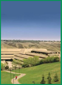
My main personal interest is my family: my wife and 2 children, and our dogs (Labrador Retrievers), cats (~2) and various other creatures. I also enjoy league sports (especially ice hockey and soccer) and outdoor recreation such as mountain biking, skiing, scuba diving, hiking, and exploring the large river valleys and parks in and around Lethbridge as well as the diverse landforms and nearby Rocky Mountains of southern Alberta and south-eastern BC. CONTACT ADDRESS AND E-MAIL Dr. Derek R. Peddle Professor, Department of Geography
Go to: Geography Department Go to: University home page derek.peddle [ at ] uleth.ca |
||||||||||||