Aug 19/2010 |
Geocache Activity 820 |
FIND 757 |
IDENTIFICATION
Difficulty 1; Terrain 1; size ?; Creator: Neko&Hiiri Date First Hidden: 10/15/2007 Date Last Found: 7/27/2010 Description Have you ever been driving around the prairies, gone down into a valley and noticed that the bridge at the bottom of the valley is really short? Better yet, have you noticed that the stream you just crossed was no more deep and wide than a speedbump? As you look around, you wonder to yourself “how did that tiny little stream cause this huge valley?”
Callum Creek is one such place. Beautiful vistas, gorgeous sunsets, a nice gently winding highway... And a stream you could jump over.
This is known as a “misfit stream.” A misfit stream (in this context) refers to a stream that has carved out a valley of this size, but couldn’t possibly do so. It is also located at the bottom of a U shaped valley – a “glacial valley”. This valley was carved by glaciers during the last ice age. The glacier carried along with it glacial till – the sediment, rocks and other debris that it picked up on its trip. As the glacier melts, these deposits settle into the bottom a V-shaped valley (the more traditional river valleys, like those you may see in the mountains.) This creates the characteristic U-shaped river valley, and the sediment becomes a kind of flood plain. After the glacier recedes, the stream or river may return, and will now be known as a misfit stream. The sides of the valley are smoothed out from the movement of the glacier. These hills may have been pointed at one time like others to the west (see the Google Earth image.) The glacier would have worn these down and smoothed them out, with the centre of mass over the valley. The hard and fast rule about a glacier valley is that if you can see it, the glacier is gone. To log this cache: Stop at the posted coordinates; they provide a nice vista of the valley in question. Email the owner the following information: Looking south (down the valley) estimate how far across the valley is, peak to peak. Estimate how high the sides of the valley are from the valley floor.
Hint Comments
PLANNING
I set up a route that would involve 12 geocaches along Highway 22 north of Pincher Creek. I also made note of 4 caches in Claresholm in the event that I had time left after the first 12 had been searched. The intent was the simple one of trying to clear the southern end of the valley between the Porcupine Hills on the east and the Livingstone Range on the west of all "unfound" caches. I left home about 7:30 am.
OUTCOME
1:50 PM This was my 9th search of the day. I am on Highway 22, heading south.
Here is my posting to the geocaching.com website:
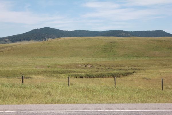
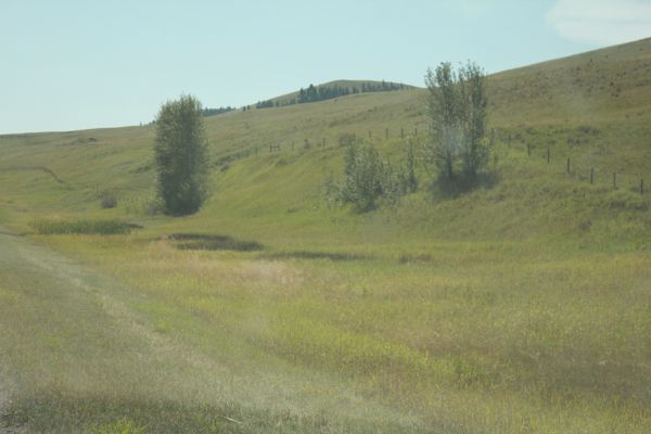
The entire route along Highway 22 is gorgeous. Email is on the way. Here are two photos:
view looking east
view looking west
I am now 9/9 for today.


