Aug 16/2010 |
Geocache Activity 808 |
FIND 745 |
IDENTIFICATION
Difficulty 1; Terrain 1.5; size ?; Creator: smartee Date First Hidden: 6/17/2009 Date Last Found: 8/15/2010 Description You can drive right up to the site. In the late 1970s I hiked using his journal the route followed by the first European explorer into what is now Waterton Lakes National Park. Today a plaque sits along the valley he descended where you will have a magnificent view of the mountain that now bears his name. TO LOG THE CACHE Go to the posted coordinates and after reading the plaque jot down the name of the explorer and the date he descended the valley. (You will probably want to take a picture of the mountain and valley from this spot - but that’s up to you.) Now go to the following waypoint: N 49° 03.075 W 113° 54.402 This is the Heritage Centre of the Waterton Natural History Association. Tell the friendly staff the name of the explorer and the date he arrived in the park. They will have you sign the log book and you can pick up a prize for your effort. It is a trail guide of his full journey through the Rockies that I published after I traced his route years ago. Maybe you or someone you know will someday also want to follow in his footsteps. It is an amazing journey with its own story through mountains with landscape little changed today. Hint Comments
PLANNING
I set up a route last night that would involve a total of 9 searches. I was not sure how many would be possible as three of the searches would involve some hiking, which is often difficult to estimate in terms of time taken. Then there is always the unknown factor of how long it actually takes to spot the cache once one is in the area. And there will also be a fair amount of driving between caches, sometimes on rural gravel roads. It promised to be a full day. But the weather was perfect: sunny, warm, no wind, blue sky.
OUTCOME
12:40 PM This was my 6th search of the day. It was lmost exactly two hours since I last logged a search. I had to walk from the previous cache to the truck which took about 45 minutes, then drive to the plaque for this cache along the Red Rock canyon road in Waterton National Park, then drive back and into the townsite.
Here is my posting to the geocaching.com website:
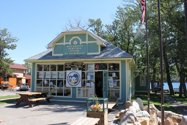
I will always have a soft spot for a cache within our National Parks. This one is especially rewarding. I had a wonderful chat with the lady manning the counter - I think she will likely become a geocacher before long. Thanks for the book. SL. TFTC. Here is a photo of the Waterton Heritage Center where I received the free book for correctly answering the two questions (I forgot to take a photo of the plaque).
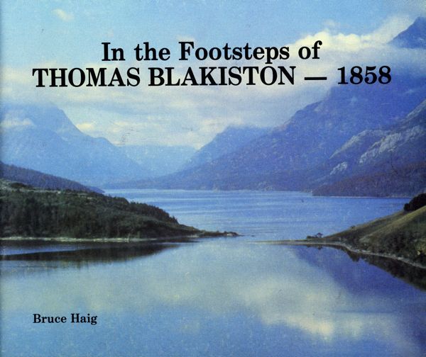
I am now 6/6 for today. Here is a scan of the cover of the free book.


