May 1/2010
|
Geocache Activity 654 |
FIND 596 |
IDENTIFICATION
Difficulty 3; Terrain 2; size Creator: Midnight Sun transplants Date First Hidden: 10/29/2007 Date Last Found: 4/11/2010 Description This is a night only cache, designed to be fairly easy to do at night, but very difficult during the day, located in the Elizabeth Hall Wetlands. It shouldn't take any more than roughly 45 minutes to complete. The posted co-ordinates are not the cache location, they are your starting point. Your goal is to pick up a series of clues consisting of binary digits, which when converted to decimal numbers, form the missing digits for the co-ordinates of the actual cache. The clues are a visual representation of four binary digits, with the color red representing a 'one' and white representing a 'zero'. The sequence can be either horizontal or vertical. Examples: Horizontally: W R R W = 0 1 1 0 = 0X2^3 + 1X2^2 + 1X2^1 + 0X2^0 = 0 + 4 + 2 + 0 = 6 Vertically: W = 0 = 0X2^3 = 0 W = 0 = 0X2^2 = 0 R = 1 = 1X2^1 = 2 R = 1 = 1x2^0 = 1 = 0 + 0 + 2 + 1 = 3 A good flashlight is a must, as those with a weak throw may not be sufficient to illuminate the clues. Holding the flashlight higher along the same plane as your eyes makes it much easier to see the reflections. You will need a good set of batteries in your GPSr, as the backlight will be on most of the time. If you're having difficulty spotting a clue, try moving ahead or back on the trail up to 10 meters. I have had some pretty poor signal quality in this area. Note that the parking area is gated and the posted sign indicates that the gate will be closed from 8:30pm until 6:00am from October 1 to April 30. If the gate is closed, there is room for parking outside of the entrance, with only a short walk to the starting point. The route to the cache is along a well defined trail that is easy to navigate at night, so no bushwacking is required. Once you locate the cache, the shortest route back to the starting point is to just continue along the path that you have been following. Have fun. The co-ordinates of the cache will be: N49 42.CEA W112 52.DFB Your quest begins at N49 42.377 W112 52.185 Stage 1 (A) From the starting point, proceed 170 meters Northeast along the trail, keeping to the left. This is your actual traveled distance, not straight line distance. I think most GPSr's have an elapsed distance or trip odometer function, which is what you will want to use between points. You will find the first clue in this vicinity. Stage 2 (B) Continue along the trail in an easterly direction until you come to the set of stairs. From the top of the stairs, proceed 265 meters on a southerly heading along the trail. The second clue is in this area. Stage 3 (C) Continue heading south for another 220 meters. Here is the third clue. Stage 4 (D) Keep heading south until you reach the stairs on your right. Take the stairs down, and you will quickly come to an intersection of two trails. From the intersection, proceed 20 meters north along the trail. The fourth clue can be found here. Stage 5 (E) Continue north along the trail for 170 meters. This is the fifth clue. Stage 6 (F) Another 115 meters north on the trail will bring you to the sixth and final clue. Hint Look up, look down, look all around. Comments
PLANNING
I have been aware of this cache since I first began geocaching but had never attempted it because of the nighttime aspect and I do not have a good flashlight. About a week ago I noticed that a new geocacher had tried it during the day and found it.
I was enthusiastic to do some geocaching following the brunch get-together earlier this morning where a group of local geocachers met to celebrate the 10th anniversary of the activity. What better cache to try than this one?
OUTCOME
This was pure fun!
It gave me a lot of difficulty but I finally found all 6 of the markers and then quickly found the actual cache.
Stage 1: I had no problem walking to the first coordinates. The next step was to walk 170 meters. I had never used the feature on my GPS that kept track of distance but soon realized how to do this. Incredible. Over a year later and I am still learning how to use the device.
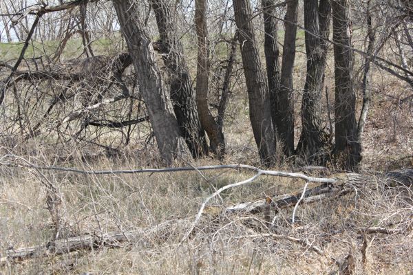
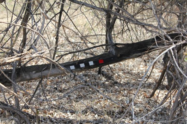
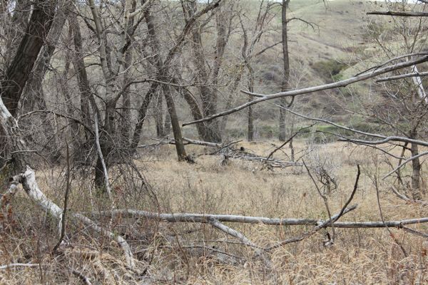
I walked the 170 meters and then began looking around. It only took a couple of minutes before I spotted the first marker. I would estimate the marker was about 30 meters from where I was standing. It was not that easy to see but still quite manageable. The pattern was WWWR which translates to 0+0+0+1 = 1. Therefore A = 1. I was optimistic that this would be doable.
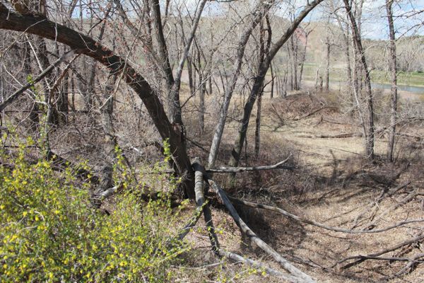
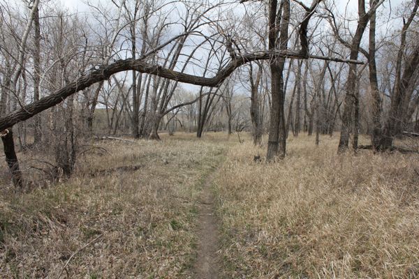
view from the first location
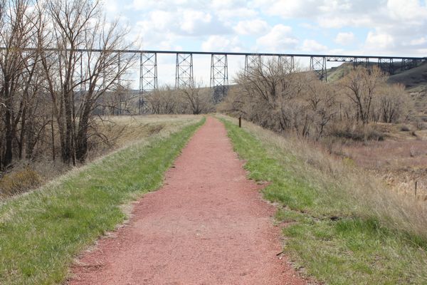
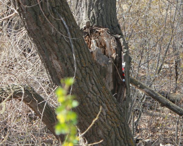
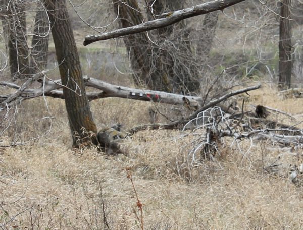
close-up of horizontal branchStage 2: I followed the directions to the set of stairs and then reset my GPS trip to 0 and walked 265 meters. to the second location. Once there, I scanned the trees in all directions and after about 5 minutes noticed the tell-tale strip. I was beginning to realize that it would be nice to have a pair of binoculars. The pattern was WRRW which translates to 0+4+2+0 = 6. Therefore B = 6.
walking 265 meters down the path
looking west
close-up of large treeSo far, so good. Two patterns found and four to go. This should take about an hour.
Stage 3: I walked another 220 meters down the red shale path and then began looking around. After 20 minutes I still had not spotted the strip of markers. At this point I realized that I could continue to the next stage and then return to this spot later when I had developed a better sense of what to look for. I put a couple of scuff marks on the side of the trail and continued on.
Stage 4: I walked down the stairs, found the intersection of two trails, walked 20 meters, and began looking. Same result as with Stage 3. Not so good. I was now 2 for 4 and it was becoming obvious that this was going to be a challenge. Two more scuff marks and I move on ...
Stage 5: 170 meters down the trail and another scan of the terrain. Still nothing. This is becoming serious.
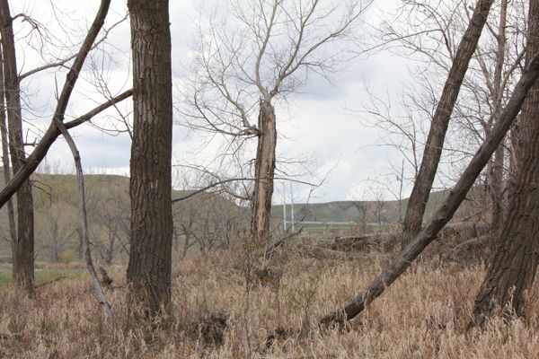
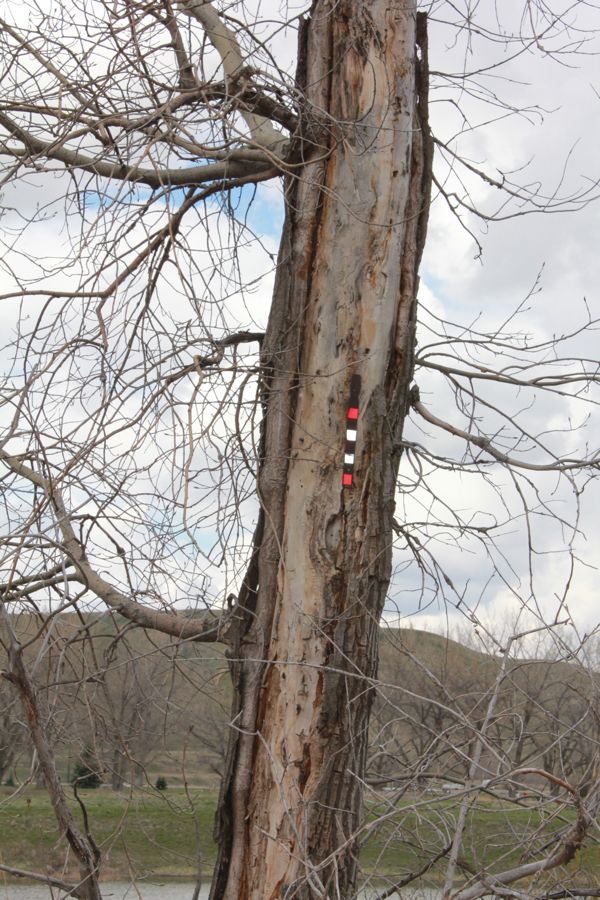
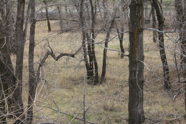
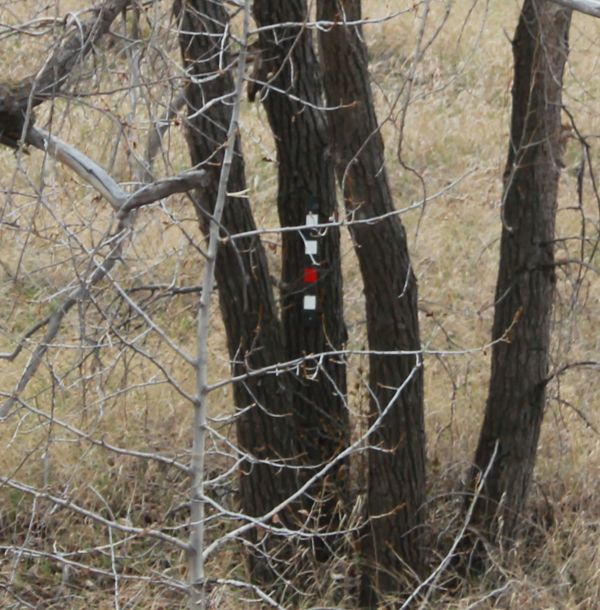
Stage 6: 115 meters to my last try. This took awhile as well, but then I saw it. It was much further away than the first two stages. This was what I needed - a better sense of what to look for. The pattern was RWWR which translates to 8 + 0 + 0 + 1 = 9. Therefore F = 9.
the center tree
close-upNow I realized that I needed to scan the trees that were further away than I had been considering. I was now ready to try Stages 5, 4 and 3 again - in reverse order as I retraced my path. At least the scuff marks would be useful. Although I was a bit apprehensive that I would need to return home and find my binoculars. But there was no mention that the previous daytime geocacher had needed binoculars.
Stage 5 (2nd try): This time I saw it (barely). It was even further away. The pattern was WWRR which translates to 0 + 0 + 2 + 1 = 3. Therefore E = 3. I was now feeling a bit better about how to scan the surroundings - looking at trees that were over 50 meters away. I felt that must be close to the further limit as a flashlight would have to able to light up the markers. I had now found 4 of the 6 markers.
the horizontal tree in the background
Stage 4 (2nd try): I spent almost 30 minutes at this location and still couldn't see it.
Stage 3 (2nd try): This was a startle. I returned to the first scuff marks I had made on the side of the shale path and almost immediately saw the markers. They were plainly visible - I couldn't believe I hadn't seen them the first time, even though they were a bit further away than the trees I was scanning. The pattern was WWRW which translates to 0 + 0 + 2 + 0 = 2. Therefore C = 2.
center tree
close-upBack to Stage 4 ...
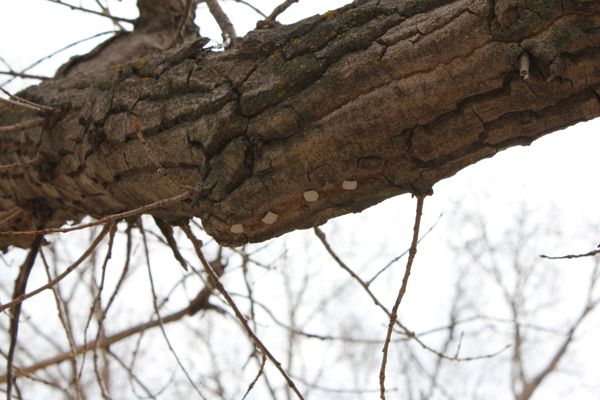
Stage 4 (3rd try): I walked around the area at a distance of about 40 meters from my scuff marks in the hope that I could see the markers if I were closer to them. This proved fruitless. I returned to the scuff marks and stood there trying to think of what to do next. Then I happened to glance up at the tree that was overhanging the path. There were 4 small white squares embedded in the underside of the tree. I couldn't see them unless I was directly under the overhang. Thus D = 0.
overhanging tree
4 white squares!I now had the complete coordinates for the cache. N49 42.CEA W112 52.DFB = N49 42.231 W112 52.096.
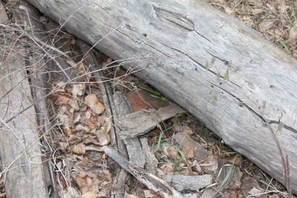
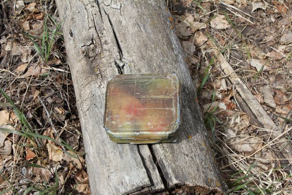
cache location
successHere is my posting to the geocaching.com website:
My thanks to Joci for indicating this cache was doable during the day! This was one of the most enjoyable multi-caches that I have experienced. A great idea with lots of variety (almost too much variety). TNLNSL. TFTC! I am now 2/2 for today.
