Mar 16/2010
|
Geocache Activity 601 |
FIND 547 |
IDENTIFICATION
Difficulty 2; Terrain 2; size regular Creator: Corey, Laura, Ron, and Lorena Date First Hidden: 1/13/2002 Date Last Found: 3/14/2010 Description Park in campground parking lot at N49 31.246' W114 01.947'. Enjoy your walk! Located near the windmills used to power Calgary C-Trains, this cache was left in honor of 2 beloved pets. The critters carefully put the items in a coffee tin covered with attractive floral mac tac. Hint This cache is hidden on the river bank towards the windmills. Comments
PLANNING
I was eager to begin today's activities. Yesterday I learned how to use geocaching.com's "Create Pocket Query" to obtain all the caches along a route (in this case Highway 3 between Pincher Creek and Sparwood). This gave me a total of 49 caches to search. This was a .loc file. (The geocaching.com website says that I should be able to obtain this as a .gpx file but I have not been able to figure out how to do this yet.) I then had to convert this to a .gpx file using a program called GPSBabel. I then used a program called Garmin Road Trip to see these caches located on a map on my Mac. This is the same map that my Garmin nuvi uses for its display. This gave me a clear picture of the location of each cache along the highway before I set out. I then downloaded these caches as a .gpx file to a file folder on the Mac desktop and I dragged this folder to the Garmin nuvi (in the folder called GPX) which was hooked up to the Mac. This may seem like a lot of work, and it is, but it is still much better than having to load each of the 49 web sites individually into the nuvi.
I took along my BT-335 data logger, my Garmin nuvi, my camera and my iPhone. I did not make any notes as I assumed I would be able to use my iPhone to obtain the cache descriptions and details. I also did not make any notes about the sequence of searching as I assumed the nuvi would always indicate which cache was the next nearest and that would work satisfactorily as I was basically following a linear route.
OUTCOME
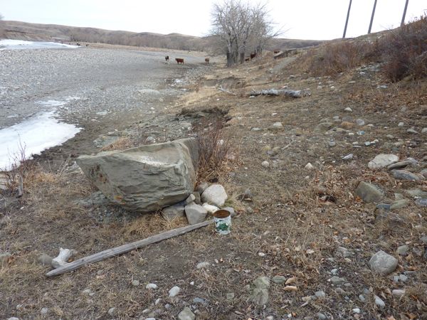
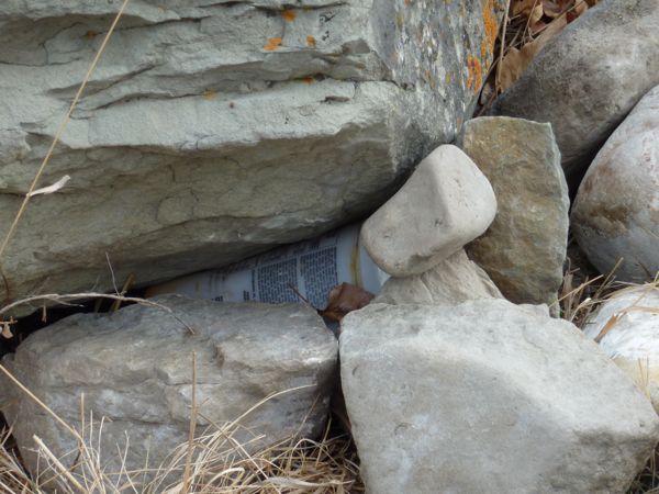
This was my third search of the morning. This one also gave me a lot of difficulty. My nuvi kept directing me to an area close to the roadside and about half way up a hill. I finally widened my search area and then noticed the floral can beside a clump of rocks. The cache was in the clump of rocks. Here is my posting to the geocaching.com website:
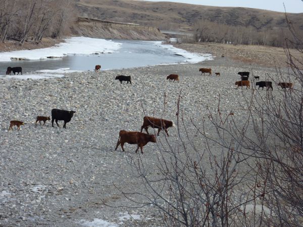
It was only when I widened my search area, and opened my eyes, that I finally found it. The gate was open and I was able to drive about 3/4 of the way in before deciding to take a stroll. Lovely area. Lots of young calves, and their moms, about. I was impressed with the cattle. They were let out of a paddock and with no supervision meandered over to the stream, had a drink, and then returned to the paddock.
Here are some photos:
floral mac tac container
new container
well-trained cattleI am now 2/3 for today, but it was now 11:10 am and I had only carried out 3 searches. I am averaging about an hour between searches. I was expecting to be doing better than this.
