Mar 5/2010
|
Geocache Activity 586 |
FIND 533 |
IDENTIFICATION
Difficulty 1; Terrain 1; size virtual. Creator: outforthehunt Date First Hidden: 8/12/2001 Date Last Found: 2/4/2010 Description The Medicine Tree was a freak of nature, a double cottonwood tree with a common, entwined branch growing about ten feet above ground level. To the natives it not only symbolized a campground, which combined a pleasant clearing on a tree-lined river bank, adjacent to a convenient fording spot across the Highwood, plentiful grazing, firewood, and berries; it also was said to have supernatural powers and offerings of food, tobacco and arrowheads frequently were made beneath its branches. Eventually the aging Medicine Tree was felled by a windstorm, and lay rotting for some time on the premises of the Round Top T Ranch. A number of interested citizens, together with the High River Rotary Club, salvaged a part of the old landmark and it was placed on an arch in George Lane Memorial Park in High River. It has become the official copyrighted symbol of the Town of High River and its residents, and numerous souvenirs using the emblem have traveled around the world, indicative of the "good medicine" of friendship, pleasant surrounding and the blessings of a good land... High River, Medicine Tree Country." 1. Wolves of the Wild N 50° 34.829' W 113° 52.320'
2. Fly Boys N 50° 34.811' W 113° 52.420'
3. Cattle Drive N 50° 34.765' W 113° 52.436'
4. Threshing N 50° 34.750' W 113° 52.427'
5. The Chucks N 50° 34.730' W 113° 52.354'
6. "Old Womans Buffalo Jump" N 50° 34.712' W 113° 52.379' 7. "Fort Spitzee" Trading N 50° 34.768' W 113° 52.387'
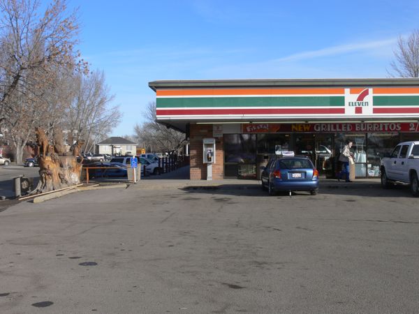
To log a find what store is east of the wolves? E mail me the answer. Visit High River siteHint This is a virtual cache tour of High River showing the various artists paintings and carvings. While you are here visit "Rainbow Treasure" and "Cisco's Stash cache" Comments
PLANNING
I had to take the Camry in to the High River dealer for factory recall maintenance. Since I was in the area I thought I would try to find a few caches in the townsite. I was not sure how much time I would have so I restricted myself to 5 sites. My original idea was to do a little geocache searching after the car is ready. This was the first time I have used the new Garmin nuvi since it was replaced earlier this week. I also took advantage of this trip to try the BT-335 data logger and see if I could obtain a map of my route from Lethbridge.
OUTCOME
This was my second search of the morning. It was just a short drive down main street from the first search.
Here is my posting to the geocaching.com website:
Email has been sent. Thanks for the cache.
Here are a few photos:
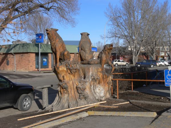
Wolves of the Wild
store east of the Wolves
The Garmin performed perfectly. I will see if I can obtain a map of the trip from the BT-335 later. I also want to see if I can geotag these photos. Later.
I am 2/2 for today.


