Learning: The Journey of a Lifetime
Journals as an Aid to Learning
Afghanistan
afghan2 |
An Example of a "Learning Process" Journal (using the 2 colored box format) |
September
6 , 2003 |
|
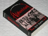
Book: Afghanistan by Louis Dupree Source: Oxford Pakistan Paperbacks. Oxford University Press, 1973. |
This is my second day where I am spending a clear hour focusing on Learning more about Afghanistan. It is 7:45 am (Saturday) and I have both the day, and a cup of coffee, in front of me. I located a book I had read this spring (An Unexpected Light by Jason Elliot - 1999) and in the process of trying to find it, I discovered another that I had purchased at about the same time (Afghanistan by Ralph Magnus & Eden Naby - 2002). This latter book purports to be a history since 1973, and nicely dovetails with the Dupree book. What did I learn from reading the Elliot book?
The goal is to make this summary richer and more detailed, particularly with respect to the culture and history. I have just tried drawing a map from memory of Afghanistan. I have identified 3 cities (Kabul, Herat & Kandahar) and have 3 bordering countries (Pakistan, Iran, China) marked but am very unsure of the northern border. I have also identified the main mountainous area beginning in the "panhandle" and stretching in a southwest direction through much of the country. I will try to scan this into this web site and compare it with a real map. I should also see if I can create a timeline of important events and a list of important people. I will try that on my next "study session". |
Part I The Land
Afghanistan is dominated by the central mountainous core called the Hindu Kush. There are many north-south passes through these mountains. The west and southwest are very dry and consist primarily of stony desert. Most of the country is semi-desert or mountainous.The area around Jalalabad is often described as lush, but even this area requires irrigation to grow citrus fruit, rice and sugar cane. The mountains do not act as barriers, but more like funnels, as they channel people along well-worn routes from one area to another. Most mountain passes are impassable during the winter. Chapter 1 (pp. 3 - 31) describe 11 geographic zones. 6 of these zones (the main 2/3 north-east portion) are part of the Hindu Kush mountainous region. The other 5 zones in the west and south are primarily desert or river valley plains.
|
| I haven't made much progress this morning (only on page 8). I am still having difficulty remembering the three countries to the north (Turkmenistan, Uzbekistan & Tajikistan). I spent about 20 minutes looking for images using Google. |
Reminder: each "Learning" session has a new web page.
E-mail: dale.burnett@uleth.ca |